


240429 EMINES

guy284
User
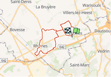

Length
13.1 km

Max alt
191 m

Uphill gradient
160 m
Km-Effort
15.2 km

Min alt
131 m

Downhill gradient
159 m
Boucle
Yes
Creation date :
2024-04-29 12:00:56.221
Updated on :
2024-04-29 15:10:05.48
2h42
Difficulty : Difficult

FREE GPS app for hiking
 SityTrail
IGN / Geographical institutes
SityTrail Plus
The world is yours!
About
Trail Walking of 13.1 km to be discovered at Wallonia, Namur, La Bruyère. This trail is proposed by guy284.
Positioning
Country:
Belgium
Region :
Wallonia
Department/Province :
Namur
Municipality :
La Bruyère
Location:
Unknown
Start:(Dec)
Start:(UTM)
630440 ; 5597129 (31U) N.
Comments